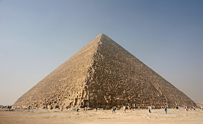
(The Great Pyramid, 2005. Photo credit: By Nina - Own work, CC BY 2.5, https://commons.wikimedia.org/w/index.php?curid=282496)
Egyptian pyramids mystery solved: Just add waterIt's long been a mystery: how did the ancient Egyptians transport tons of heavy stones to the middle of a desert to build their most famous pyramids? Research published last week suggests that a now-dry river known as the Ahramat played a key role. It was once a branch of the Nile, connecting the major city of Memphis to the site of the Giza pyramid and beyond. But a major drought, some 4,200 years ago, might have led to its disappearance. Read the new findings on how the Egyptians built the pyramids.
SHORT VIDEO EXPLAINER: https://youtube.com/shorts/qyx7Z9SL17k?si=2dXik_vPe6achDOCNow, according to a new paper from the peer-reviewed journal Nature – published on May 16, 2024 – the answer is simple. A chain of pyramids was built where, once, there was a river. We now call that ancient river the Ahramat, and it was a branch of the famous and very necessary Nile River.
It’s well known that civilizations settle where there are sources that will let people thrive. And to be sure, one of our most valuable sources is water. So, why would this advanced civilization build the famous pyramids in a desert? The answer, in fact, could well be this branch of the Nile, which has now disappeared.
There are thousands of pyramids in the world. Notably, around 100 are located in Egypt. And 31 of the Egyptian pyramids – including the Giza pyramid complex – were built along this 40-miles-long (64-km-long) stretch, called the Ahramat. These pyramids are concentrated in what is now a narrow, inhospitable desert. But when the ancient Egyptians built them over a nearly 1,000-year period, starting approximately 4,700 years ago, that area of the Western Desert – part of the Sahara – wasn’t entirely dry, scientists say.
(Photo: The water course of the ancient Ahramat branch borders a large number of pyramids dating from the Old Kingdom to the Second Intermediate Period. Image and caption via Eman Ghoneim.)
Formerly, the Nile River used to have several branches. And the Ahramat branch was also close to the ancient Egyptian city of Memphis. This means that the pyramids were concentrated near the city and the river. Indeed, the pyramids would have been easily accessible via the river branch at the time they were built.
In addition, the authors of the paper found that many of the pyramids had causeways, which ended at the riverbanks of the Ahramat branch. This is evidence that the ancient Egyptians used the river for transporting construction materials, among other things.
How do researchers know?
Also, sedimentary evidence suggests that the Nile used to have a much higher discharge, with the river splitting into several branches.
With this in mind, the authors of the paper used satellite imagery to look for a former river branch running along the foothills of the Western Desert Plateau, very near to the pyramid fields.
In addition, they also used geophysical surveys and sediment cores to confirm the presence of river sediments and former channels beneath the modern land surface.
What happened to the river?
Over time, this branch of the Nile River became buried beneath farmland and desert. The authors suggest that an increased build-up of windblown sand, linked to a major drought which began approximately 4,200 years ago, could be one of the reasons for the Ahramat’s eventual silting up.
And, just like it happens to Venetians with their channels and gondolas, this now-dry river was an extremely useful source for Egyptians.
The results emphasize the significance of the Nile as a vital route and cultural lifeline for ancient Egyptians, while also shedding light on the historical impact of environmental changes on human society.
Moreover, further exploration to uncover additional extinct branches of the Nile could assist in prioritizing archaeological digs along its shores and safeguarding Egyptian cultural legacy.


No comments:
Post a Comment