Recently, we visited the Fort McClary State historic site in Kittery Point, Maine. When we visited in early July, the fort, that sits atop a hill facing the Piscataqua River, was enshrouded in fog. Today's blog will tell you about the fort, its 8 structures (3 of which don't exist anymore), 6 wars, and history through the centuries.
(Photo: Rob and Tom at the fog-enshrouded Fort McClary State Historic Site). WHAT IS FORT MC CLARY? Fort McClary is a former defensive fortification of the United States military located along the southern coast at Kittery Point, Maine at the mouth of the Piscataqua River. Pepperrell Rd, Kittery Point, ME 03905
FORT MANNED DURING 6 WARS - It was manned during five significant wars including; the Revolutionary War, War of 1812, Civil War, Spanish-American War, World War I and World War II.
6 TYPES OF STRUCTURES MADE UP THE FORT: There were 6 types structures (and 8 total) that made up the fort and several no longer exist. There remains the Blockhouse, the Magazine building, 2 Caponiers, and the Powder Magazine. There was also one building that housed Barracks, and 2 buildings called "Rifleman's House."
(Photo: The white 3-story building is the Blockhouse, with the magazine to the right. Credit: R.G.)
1) THE BLOCKHOUSE - Fort McClary's Blockhouse is a uniquely designed military structure. It's 3 stories. Beginning in 1844, the Blockhouse took 2 years to build and was constructed in three different layers from materials in the surrounding area. Its foundation (basement) is built of mortared fieldstone, the first-story walls are of cut granite, and the second story is built of squared logs. The Blockhouse at Fort McClary was the last one of its kind constructed in Maine.

(Photo: One of 2 cannons on top of the Caponier. Credit: R.G.)
2) THE MAGAZINE BUILDING - This building was used to store the soldier's gunpowder. It was constructed around 1808 and is said to be the oldest structure on the site.
(Photo: This is where the Barracks stood. Credit: R.G.)
3) THE BARRACKS - This was a wooden building that no longer exists. But a Barracks used to stand on the Fort grounds beside the Magazine. The Barracks were the sleeping quarters for soldiers stationed there. It was built in 1808 and remained into the 1900s until it collapsed. Today, you can see stones in the grass that outline the walls of the structure.


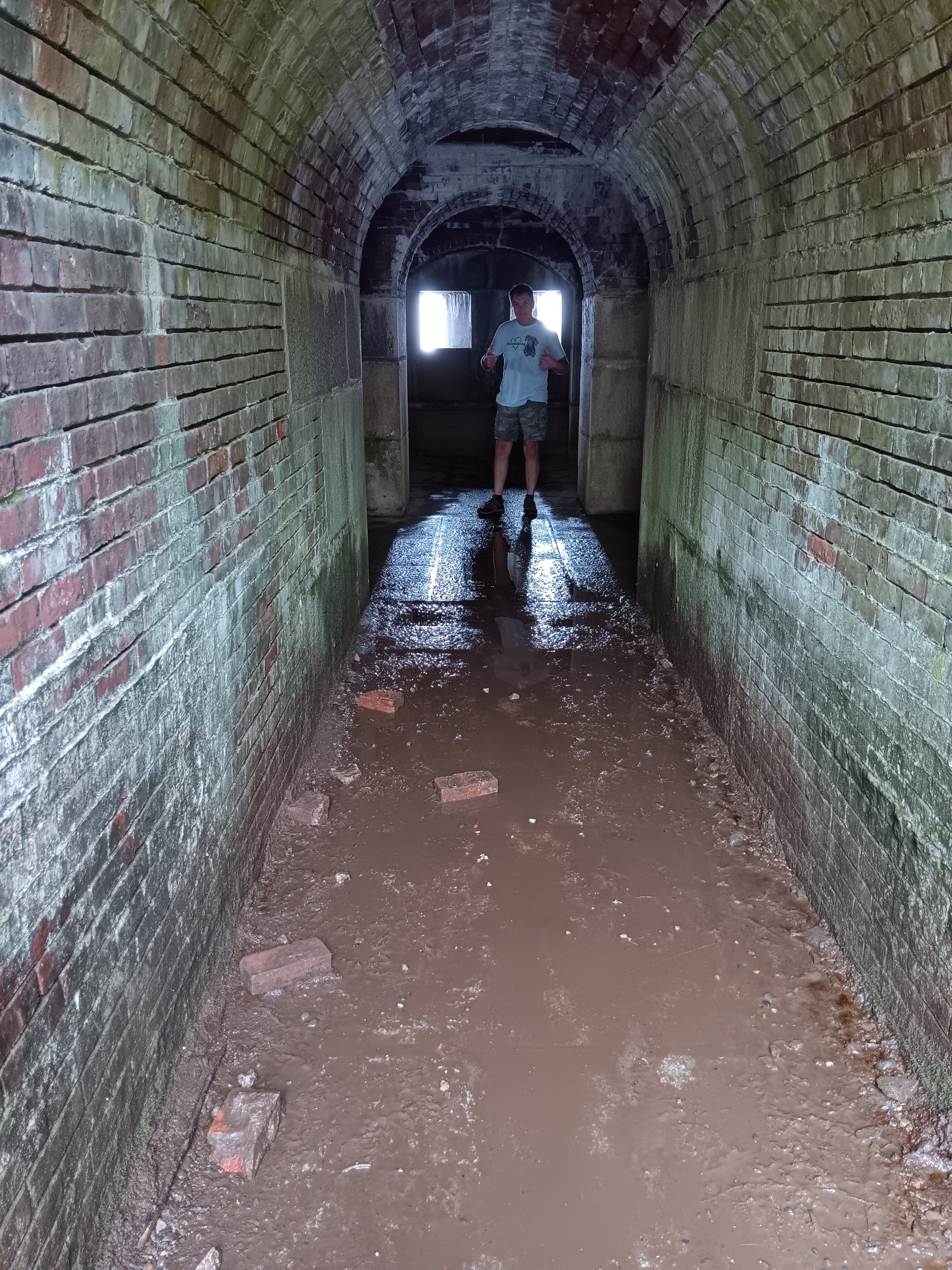
(Photo left: The long hallway to the end of the Caponier where guns would be stationed. Photo right: Entrance to one of the Caponiers. Credit: R.G.)
4) TWO CAPONIERS - A caponier is a type of defensive structure in a fortification, like a ditch. Originally the term referred to a covered passageway that traversed the ditch between the walls of a fortress and a ravelin outside the wall. There are 2 of them and they are stone tunnels that end with windows where rifles could be fired at enemies. 
It is a passageway where firepower could sweep the ditch between the ravelin and the curtain wall and inflict devastating damage on any attempt to storm the wall. Thus the passageway was equipped with musket ports and cannon ports that fired along the ditch.
The word originates from the French caponnière, meaning "chicken coop." Two caponiers are unfinished and are located in front of and behind the Blockhouse. We noticed that outside, the roof of the caponier was curved. The reason is that because the roof is vulnerable to fire, being curved (and thick) helps deflect falling bombs/shells.
5) - THE GRANITE POWDER MAGAZINE - During the years of 1864-1868 the Granite Powder Magazinew was built. It was designed to hold the powder for use in the cannons.
(Photo Right: The Powder Magazine. Credit: R.G.)
6) THE RIFLEMAN'S HOUSE(S) - Likely built around the same time as the blockhouse, these 2 small square buildings, located on opposite corners of the fort ground, where where riflemen were positioned to shoot at attackers. These brick buildings had small windows to keep riflemen safe. None of these remain standing today.
FORT MODIFICATION DURING THE CIVIL WAR - From 1864 to 1868, the granite walls surrounding the Fort were assembled to make enclose the fort. It included an enclosed structure that house two tiers of cannons.
REMAINS UNFINISHED - When you walk around the grounds of the fort you'll see huge granite blocks scattered about. Those were intended to finish the fort, but it was never completed. Near the Civil War's end, advancements in weapon technology made it obsolete.
WHO WAS THE FORT NAMED AFTER? The fort was named after New Hampshire native Major Andrew McClary, who died at the Revolutionary War's Battle of Bunker Hill.
(Photo: A fog enshrouded photo of the Piscataqua River. Credit: R.G.) PHOTOS BELOW - Below are pictures of the signs from the grounds of the fort.NEXT: The Residual Haunt of Fort McClary!


 WHERE IS FORT MCCLARY? - Fort McClary State historic site in Kittery Point, Maine. The fort sits atop a hill facing the mouth of the Piscataqua River. It is a former defensive fortification of the U.S. military located along the southern coast at Kittery Point, Maine. It was manned during five significant wars including; the Revolutionary War, War of 1812, Civil War, Spanish-American War, World War I and World War II. FOR MY 2024 BLOG ON ITS HISTORY, CLICK HERE.