
As a meteorologist (now retired), it doesn't surprise me all that much to see Wisconsin Tornadoes in February, more flash floods and droughts, more powerful, numerous and earlier hurricanes and typhoons forming. That's what a warming climate does. We'll see more of these extremes as the world continues to warm. Here's a compilation of the 10 oddest weather-related things in 2024 from Weather Underground.

The 10 Strangest Things We Saw In 2024's Weather
Jonathan Erdman, Weather Underground2024 was a year of weird weather, from snow to hurricanes, floods to drought, and wildfires to tornadoes.
Some of these events were unusual for where or when they occurred. Others were just plain bizarre.
Here is our ranked list of the strangest things we saw in 2024, followed by some other oddities that didn't quite make the top 10 list.
10. A "Crash Flood" Through A Home
The video below from Orem, Utah, in mid-August was among the most jarring I've seen of such a flash flood impacting a home.
At the beginning of the video, you can see water leaking through the windows. Then all of a sudden, a wave of water burst through into the downstairs of the Orem home.
"We’d recently been to Niagara Falls and it was like that in our home," homeowner Whitney Redd told KSTU-TV. Fortunately, nobody in the home was hurt.
A section of Interstate 15 was also flooded by enough rain and hail to prompt the Utah Department of Transportation to call out snowplows to clear the freeway.
(Further beef up your forecast with our detailed, hour-by-hour breakdown for the next 8 days – only available on our Premium Pro experience.)
9. Four Typhoons In 10 Days
The Philippines is one of the most tropical cyclone-prone countries. Even by those standards, what happened in November 2024 was extraordinary.
In just nine days in early-mid November, four separate typhoons hammered the Philippines. Three of those did so as intense typhoons: Yinxing on Nov. 7 (Cat. 4), Usagi on Nov. 14 (Cat. 4) and Man-Yi on Nov. 16 (Cat. 5). Toraji on Nov. 11 (Cat. 1) was the other.
At one time, all four storms were active at once, a first for November in the northwest Pacific Basin in records since 1951.
According to a Yale Climate Connections blog post citing the reinsurer Gallagher Re, nine other tropical cyclones were either damaging or deadly in the Philippines in 2024 from late May through the end of October, before the November rash of typhoons.
8. Latest First Snow For Mt. Fuji
Few things are more iconically Japanese than the snow-capped Mount Fuji.
But in fall 2024, it took much longer for the 12,388 foot-high peak to don its winter hat.
For the first time in 130 years, the season's first snow cap on Mount Fuji waited until November. It waited 11 days later than its previous record from 2016 and 1955, not doing so until November 6.
This first summit snow of the season usually occurs in early October. However, for the second year in a row, Japan had its record warmest fall (September through November). That kept rain falling atop the peak longer into autumn than any other year since the 1890s.
(For even more granular weather data tracking in your area, view your 15-minute details forecast in our Premium Pro experience.)
 A sign with a photo of Mount Fuji covered in snow is seen at a view point as Mount Fuji, the highest mountain in Japan at 3,776 meters, looms in the background in Gotemba, Shizuoka prefecture on October 31, 2024. Japan's Mount Fuji remained snow-less on October 31 -- the latest date that its majestic slopes have been bare since records began 130 years ago.
7. Helene, Then Milton
On Sept. 26, Hurricane Helene became the strongest hurricane to landfall in Florida’s Big Bend, and the third to landfall there in just over a year’s time. Helene pushed a modern-day record storm surge into Tampa-St. Petersburg and also a destructive surge as far south as Naples, Florida. We’ll have much more to say about Helene’s inland destruction later.
Less than two weeks later, Milton posed a danger to parts of Florida still recovering from Helene.
As weather.com meteorologist Jonathan Belles wrote in his season recap, “Meteorologists, emergency managers and residents had to worry about hurricane debris causing more damage in a second hurricane less than two weeks after Helene.”
Belles also noted some were forced to ride out Milton in their homes since hotels across central Florida were booked by those who remained homeless or in damaged structures after Helene.
Milton made landfall on Oct. 9 near Siesta Key, damaging the roof of Tropicana Field, spawning a record Florida tornado outbreak, and leaving some coastal homes buried in sand.
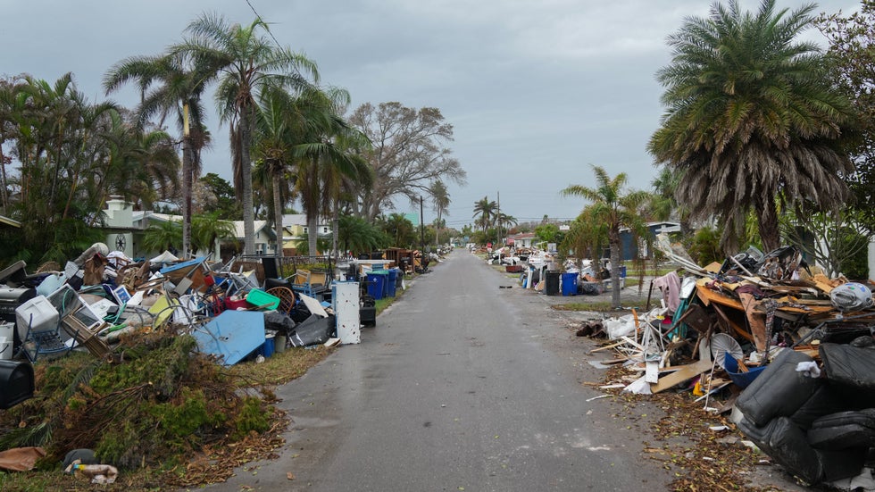 Debris from Hurricane Helene lines a street in the Redington Beach section of St. Petersburg, Florida, on October 8, 2024, ahead of Hurricane Milton's expected landfall. Milton regained power on October 8 to become a Category 5 storm with maximum sustained winds of 165 mph (270 kph) as it barrels towards west-central coast of Florida and is forecast to make landfall late October 9, according to the National Hurricane Center. (Photo by Bryan R. SMITH / AFP)
6. Tornado Destroys One Home, Leaves Next Door Untouched
Tornadoes don’t have to be large to be devastating.
One of the most extreme examples of this happened in the May 21 EF4 tornado in Greenfield, Iowa.
It left a narrow swath of intense damage through part of the town. In one extraordinary case, a home was completely demolished while the homes next door were barely touched.
You can see that in the first few seconds of the video below. Note the home with the red roof and the vacant slab left next door.
5. Earliest Atlantic Basin Cat. 5
There are many years that fail to produce a Category 5 hurricane, though not as many recently.
2024 produced a Cat. 5 earlier than any other Atlantic season on record, when Hurricane Beryl reached that threshold on July 1 after its southern Windward Islands landfall. Beryl became a Cat. 5 a whopping 15 days earlier than the previous early Cat. 5 record holder, Emily in 2005.
The following day, its winds topped out at 165 mph, the strongest July hurricane by wind speed on record in the Atlantic Basin.
Beryl toppled many other early season records, which we recapped here.
4. A State's First February Tornado Since Statehood
In records dating to 1844 - four years before becoming a state - no February tornado had been documented in Wisconsin. There hadn't even been a single February tornado warning previously issued in the Badger State, according to the National Weather Service.
On Feb. 8, 2024, two tornadoes were spawned in southern Wisconsin. These weren't just weak and short-lived. One, rated a "high end EF2", tore a 25-mile long path through Rock, Dane and Jefferson Counties that evening. "That would be a major tornado for Wisconsin any time of year, let alone February," wrote weather historian Christopher Burt in an email to weather.com at the time.
About three weeks later, only the second February tornado on record in southeast Michigan tore through parts of the city of Grand Blanc. That was also rated EF2.
(MORE: 10 Record-Breaking US Weather Moments From 2024)
3. Helene's Massive, Deadly Flooding
It wasn't enough that Helene was the third hurricane to landfall in Florida's Big Bend in just over a year's time, following Debby earlier in the season, and 2023's Idalia.
Or that Helene was the most intense hurricane on record for that area, packing 140 mph Cat. 4 winds at landfall. Or that it pushed up to 15 feet of storm surge into the Big Bend and a modern-era record 6 to 7-foot surge into the Tampa-St. Petersburg metro.
Helene's most deadly and destructive legacy was its massive inland flooding. Up to 31 inches of rain swamped the southern Appalachians in two distinct rounds both ahead of and directly associated with Helene.
On Sept. 27, the National Weather Service had over 20 flash flood emergencies - their highest level flash flood alert - in effect at one time from the Atlanta, Georgia, metro to southwest Virginia. That was the most issued for any day in at least 13 years.
This water coarsed down hillsides and through river valleys, inundating everything in its way.
In parts of western North Carolina, records that had stood since the "Great Flood" of July 1916 were smashed, including the Swannanoa River at Biltmore, south of Asheville. Perhaps most inconceivable was seeing evacuations from the rooftop of a flooded eastern Tennessee hospital.
As of the time this article was published, over 2,000 landslides were estimated to have occurred with Helene by the U.S. Geological Survey.
High winds from Helene also pushed into the southern Appalachians. Over 4 million customers were without power either due to the flooding or high winds from Florida to the Appalachians. Thousands of trees were downed, making a particularly sharp contrast with trees left standing during fall foliage season.
NOAA estimated at least 225 deaths directly from Helene's wind and flooding as of late December. That makes it the deadliest mainland U.S. hurricane since Katrina in 2005. It's also the deadliest Atlantic Basin hurricane since Hurricane Maria struck Puerto Rico in 2017.
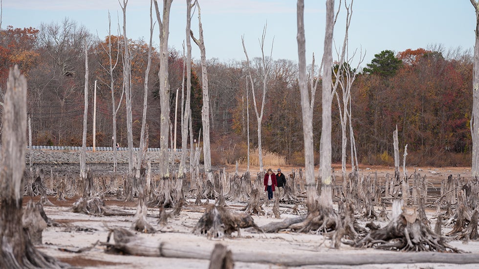
2. Northeast Wildfires, Drought In Fall
When you think of droughts, perhaps parched ground and low reservoirs in California or the South during summer first comes to mind.
But in 2024, arguably the weirdest of the nation's drought areas was in the Northeast, not just for its severity and location, but also when it happened.
Instead of late spring or summer, the nation's hottest autumn since 1895 also ended up bone dry in the Northeast, the driest on record in Connecticut, Delaware, Maine and New Jersey, according to NOAA.
Several Northeast cities set record long dry streaks, including Atlantic City, Baltimore and Washington, D.C., each going 38 straight days without measurable rain. Philadelphia's 42-day dry streak obliterated a record that stood for 150 years, and lead to their first month since 1871 without any measurable precipitation.
This eventually prompted drought warnings and other restrictions, as water levels in reservoirs, rivers, creeks and streams plunged.
And once stronger winds moved in over dried out vegetation, we had the odd sight of November wildfires in the Northeast, including parts of Massachusetts, New Jersey and New York. Massachusetts, alone, reported over 400 wildfires in November, 20 times their average, according to NOAA.
 New Jersey reservoir that supplies drinking water to 1.2M drops below half empty. New York City declared a drought warning on Monday, its first in 22 years, as the Northeast deals with severe dry conditions and brush fires during a historically dry autumn.
1. Two Bizarre Desert Floods
2024 was a terrible year for deadly floods.
We previously mentioned the mainland U.S. had its deadliest tropical cyclone-spawned flood since Katrina. Devastating floods in southern Brazil and Valencia, Spain, each claimed well over 100 lives.
But this is a list of strangest weather events, there were two desert floods that pushed this to the top of our list.
In mid-April, parts of the Arabian Peninsula were deluged by torrential rainfall. One location just south of Dubai picked up 10.03 inches of rain in just 24 hours, the heaviest such 24-hour rain event in 75 years in the UAE. Dubai, itself, picked up 6.26 inches, or two years' worth of rain, in just 24 hours.
Dubai's airport runways were flooded, which prompted flight cancellations and stranded hundreds of travelers at the airport for hours. Major roads turned into parking lots. Some abandoned their vehicles and walked. Some areas remained flooded for a few days after the rain ended. At least four were killed in the UAE and 20 died in neighboring Oman due to the flooding.
Then in summer and early fall, parts of the Sahara Desert were soaked.
This unusually wet pattern migrated farther north beginning in July and was punctuated by a September flood.
In August, over five times the annual average rainfall triggered the collapse of the Arba'at Dam in northern Sudan, according to NASA.
Just weeks after that, a strange non-tropical low pressure system pushed into northwest Africa in early September, pulled moisture northward and drenched parts of Algeria and Morocco. One village in southern Morocco picked up over 3.9 inches of rain in just 24 hours, on the order of what this region usually picks up in a year.
The resulting flooding swept through some villages, damaging homes, roads and knocking out electricity and water service. At least 20 were killed by the floods, according to the Associated Press.
But what was left behind was a startling landscape of normally dry rivers and lakes filled amidst the sandy landscape weeks after the rain. There was also increased hope this event would recharge groundwater supplies in the area after six years of drought.
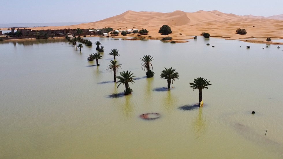 Palm trees are flooded in a lake caused by heavy rainfall in the desert town of Merzouga, near Rachidia, southeastern Morocco, Wednesday, Oct. 2, 2024.
The Honorable Mentions
Every year is a challenge to narrow this list, so here are several other oddities from 2024 that didn't make this top 10 list, but grabbed our attention nonetheless, in no particular order.
- The Las Vegas Sphere showed a melting emoji during a record heat wave.
- Four E. Pacific storms at once a first in 50 years, and they were dancing in pairs.

No comments:
Post a Comment