New drone view of William Wallace's 'hidden fort'
BBC News May 5, 2020

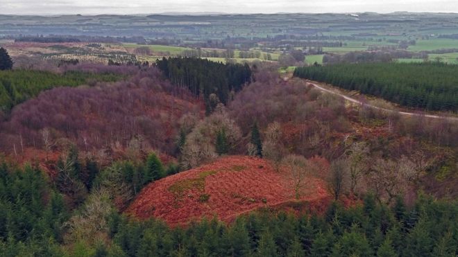
An aerial archaeological survey has produced new views of a "hidden fort" reputedly built by William Wallace in southern Scotland.
The site near Lochmaben is recorded in The New Statistical Account of Scotland published in the 19th Century.
It described the hidden stronghold as his base to "sally forth to annoy the English".
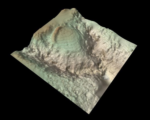
A drone was used to help survey the site - known as Wallace's House - and create a three-dimensional model.
Forestry and Land Scotland archaeologist Matt Richie oversaw the work by Skyscape Survey to examine the massive earthen rampart and promontory in Dumfries and Galloway.
'Fascinating and revealing'
He said they had been working to combine accurate surveys with "innovative visualisation techniques".
"Hundreds of photographs taken from the air by remote-controlled drone are stitched together using point-matching software to create a 3D terrain model, stripping away scrub and ground vegetation," he explained.
"It’s a fascinating and revealing technique that really begins to open up the landscape and this seemed like an ideal site to investigate.
"There isn’t much evidence on the surface, but the rampart and topography matches the historic description very well."
 GETTY IMAGES
The New Statistical Account of Scotland was compiled using responses to a questionnaire sent to every minister in Scotland.
It covers a wide range of subjects including evidence of historic ruins in their parishes.
The account describes the site of the fort with an "extensive view" to the south as a "strong place of defence".
"Sir William Wallace, while meditating the capture of the castle of Lochmaben in 1297, is said to have kept 16 men there, with whom he sallied forth to annoy the English garrison under Greystock and Sir Hugh of Moreland," it added.
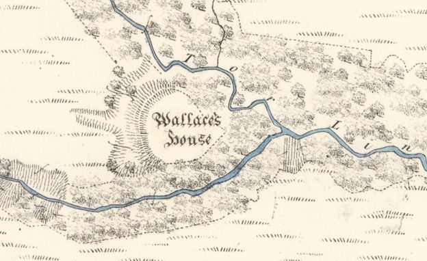
 ORDNANCE SURVEY
 FLS BY SKYSCAPE SURVEY
Mr Ritchie said the latest study added to map work which started with the Ordnance Survey of 1857.
"Our new 3D model enables the massive rampart of the fort to really stand out, and the deep gullies of the two linns to be appreciated," he said.
"It must have been the 'strong place of defence' described by the account, the rampart topped with a timber palisade and enclosing timber buildings built to house the soldiers and their horses.
"But could the fort really have been built by William Wallace and his men? I’d like to think so – and, either way, the survey has added a new chapter to an old story."
FLS regional environment advisor Bill Coombes described it as a site where ecological and heritage objectives had come together to create a "special place".
The organisation is working to restore the area to a "native condition".

No comments:
Post a Comment